Food is good. But how much more of it can we produce without doing more harm to the environment? To feed the future population sustainably, farmers will need to grow at least 70% more crops within the next 30 years. Clearly, buying more shovels or another tractor won’t solve this challenge. But unconventional approaches such as sending drones to monitor fields, using sensors for soil analysis, and other precision agriculture technologies can.
Let’s take a closer look at how new advanced technologies are changing the agricultural landscape and how early adopters of precision agriculture practices are already reaping the benefits.

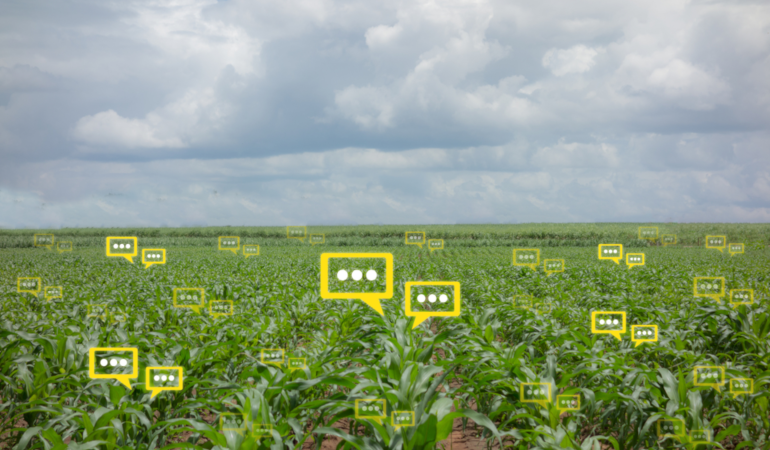
What is digital agriculture?
Growing food may be one of the oldest activities on earth. But it’s still prone to technological disruption. The increased use of technology for precision farming in agriculture is geared toward finding new ways to increase the sustainability of food production.
Digital agriculture is a combination of data and algorithms that provide specific recommendations for every square meter of a field.
In 2018, $1.6 billion of venture capital was invested in digital solutions for agriculture, like indoor vertical farming tools with a median deal size of $10 million. Governments around the world are also offering increasing support for farmers ready to embrace innovations for precision agriculture. Last year, the Australian government announced a $27 million commitment to support the adoption of digital technologies in agriculture. They also allocated $12 million for a nationwide Internet of Things (IoT) precision agriculture technology trial.
So what exactly is on the AgriTech agenda among precision agriculture companies? A host of new technologies including location-based services (LBS), Geographic Information Systems (GIS), big data analytics, IoT sensing, and drones imagery are now used by farmers who are adopting the precision agriculture technology. This adoption helps farmers increase yields, lower production costs, and minimize the impact on diminishing natural resources.
Natural resources are running out
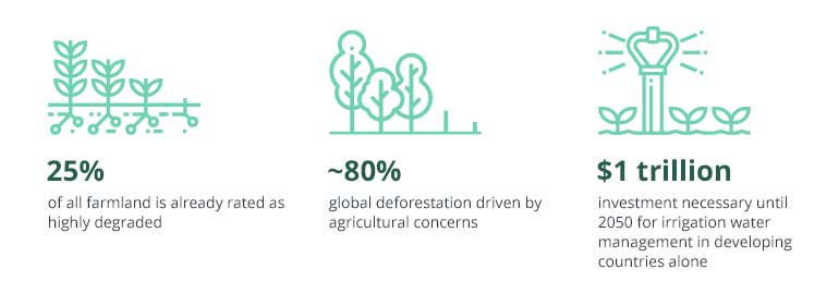
Source: World Government Summit – Agriculture 4.0: The Future of Farming Technology
These innovations in agriculture allow companies to farm, fertilize, and monitor large areas faster and with higher precision and make better business decisions. Let’s further explore how software development for agriculture can give your company an edge.
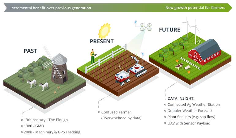
Future of precision agriculture technology

Source: Nesta – Precision Agriculture
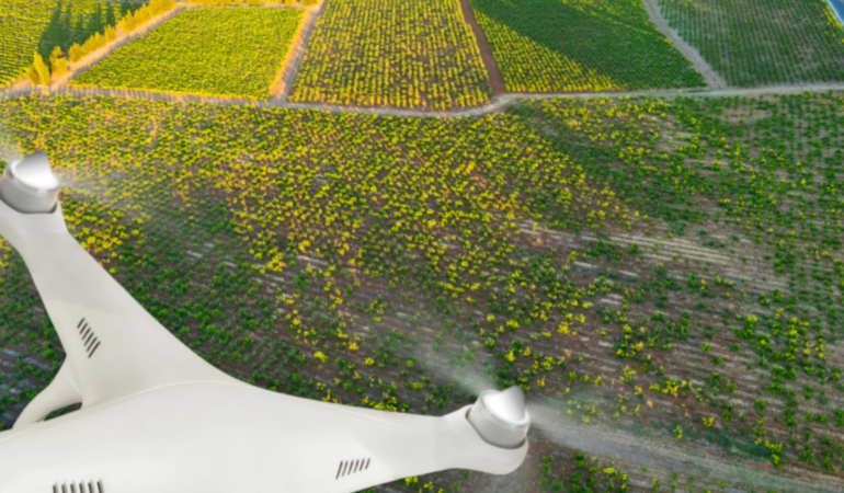
Use of drones for more efficient farming
Chartering a plane for regular crop inspections costs up to $1,000 per hour. But aerial inspections are no longer off limits for smaller agricultural businesses. Welcome the drones – your smart eyes over acres of land, available for immediate charter and data collection at an affordable cost.
Drones represent one of the newer applications of GPS in agriculture. By creating pre-planned routes, farmers can dispatch UAVs to record important metrics as frequently as needed:
- NDVI (Normalized Difference Vegetation Index) data showing plant health and helping farmers measure overall biomass at scale
- GPS coordinates of fields and additional points of interest (pest affected areas, dry or under-irrigated patches of land, etc.)
- Nitrogen levels in the soil
Bonus point: UAVs equipped with thermal sensors can also become smart herders, capturing data about livestock and notifying a farmer if any animals are missing, injured, or giving birth.
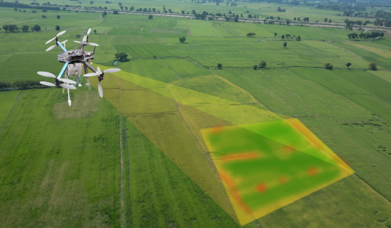
Camera and sensor-equipped drones can capture geo-information with higher accuracy and precision than human teams. All this data can then be transformed into:
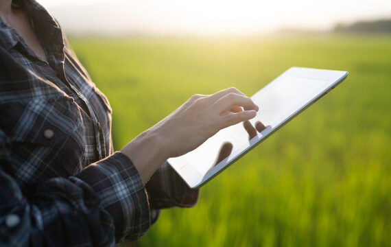
- detailed maps of crops, regularly updated with fresh information post-drone deployment – get a birds-eye view of your land by looking at a tablet, not by doing foot inspections all day long;
- new forecasts and insights into soil quality, probable crop yields, and overall crop health.
Drones have also proven effective in water conservation and irrigation. Models with thermal sensors can quickly detect leaks or breaks in irrigation systems and determine if crops are getting just the right amount of water.
A drone can cover a thousand acres in an hour-long flight. It would take a farmworker more than a week to drive up and down the same orchards in an all-terrain vehicle looking for chewed irrigation lines.
Finally, drones can go where no tractor can to spray crops with higher efficiency and precision. By approaching from above, drones can ensure even coverage on a granular level. Based on available location data, you can develop tailored routes for different farm areas and add just the right dose of fertilizer or pesticides. For one South African farmer, switching to drone spraying has reduced pesticide use by 30%.
Advanced cameras installed on drones can also capture nitrogen absorption at different stages of crop development and help farmers determine the best time to add fertilizers. French farming cooperative Ocelia says that this approach has helped them achieve a 10% increase in crop yields over the past year.
The estimated ROI of using agricultural drones is $12 per acre for corn and $2 to $3 per acre for soybeans and wheat.
Drone-powered planting is another promising area of innovation for precision agriculture companies. UAVs can be programmed to automatically shoot pods with seeds and fertilizer into the ground, even in the most hard-to-access locations. Using this method, a drone can plant 120 trees per minute.
While drone planting solutions are mainly being explored as a means to fight deforestation at scale, this innovation also holds vast potential for commercial farming.
The biggest obstacles to seeing more drones above fields are safety concerns and regulations imposed by authorities. However, those are easy to overcome through strategic software development aimed at creating easy-to-navigate and compliant solutions for agricultural companies.
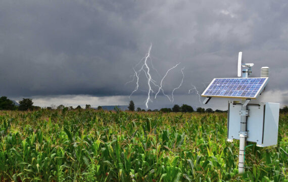
IoT sensors on the ground and in farm equipment
Automation isn’t new to farming. But the Internet of Things opens up a brave new era of precision agriculture technology.
Precision agriculture is an umbrella term for all the digital services and technological innovations modern farmers use to optimize yields, reduce waste, and maintain environmental quality.
Source: Accenture
IoT sensors placed in fields can help farmers determine:
- the right allocation of fertilizers and pesticides
- crop health
- moisture levels and soil quality
- light, temperature, and humidity levels in greenhouses
- optimal harvest time
The average farm will generate an average of 4.1 million data points per day in 2050.
The new wave of precision agriculture technology enables farmers to collect advanced soil analytics that improve decision-making and automation. Cultivation data can be transmitted to smart irrigation systems that will automatically adjust their performance to feed each plant according to its needs. Or that data can be shared with agrobots – autonomous robots capable of tackling daunting manual tasks with precision. For instance, agrobots can be deployed for hyper-local fertilizer placement, which can reduce fertilizer consumption by 99.9%.
The application of GIS in agriculture is another major trend in precision farming. GIS technology is used for conducting spatial analysis and creating visual representations of land. By using geodata from public and proprietary data sources (or data captured by drones and sensors) and big data in agriculture, you can analyze soil amendments, identify erosion at early stages, and more reliably estimate crop yields. By adding weather data to the mix, you can project current and future fluctuations in temperature and precipitation and their impact on yields. Additionally, you can conduct comprehensive risk assessments to protect your business against floods, droughts, erosion, and wildfires.
The benefits of IoT applications in agriculture extend even to sowing seeds. Modern equipment powered by sensors and location-based services can take into account the following variables:
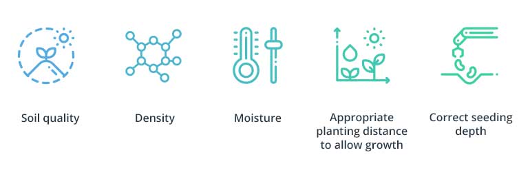
With the help of IoT technologies, seeding is no longer guesswork. Your smart equipment can be programmed to choose the ideal placement for a seed to grow and develop in the best way possible.
Once the harvest is ripe, smart tractors can enter the field to collect crops with greater care and efficiency. Currently, 80% to 90% of the energy used in crop cultivation goes into repairing tractor damage to the field. By taking advantage of GPS-controlled steering and data-driven route planning, you can:
- ensure that all vehicles follow the same track to minimize erosion;
- reduce fuel costs;
- improve accuracy for operations such as spraying, spreading, and bulk harvesting.
Using a tractor guidance system can add €18 profit per hectare for winter wheat alone. Powering such a system for precision farming in agriculture with additional GIS data (elevation, topography, slope, etc.) can help farmers gain even more value.
For an average farm using IoT, yield rises by 1.75 percent and energy costs drop $7 to $13 per acre, while water use for irrigation falls by 8 percent.
RFID sensors for food tracking and increased transparency
Consumers have become increasingly interested in where their food comes from and how it is grown. In fact, 75% of food shoppers are ready to switch to a brand that supplies more in-depth product information.
Today, people really want to feel part of their food choices, they want to feel more knowledgeable about what they’re buying, so brands have to be transparent.
And this demand creates a domino effect – food brands demand more insights from suppliers, and precision agriculture companies need to find new ways of procuring that agriculture information. That’s where RFID (radio frequency identification) readers come to the fore. These compact devices are essentially a new generation of barcodes that can be used to improve the handling and traceability of goods.
RFID benefits:
- Improved information handling. RFID tags can be used to code custom information for every box or even for individual items: product class, origin, growth conditions, etc. Unlike barcodes, they don’t require a direct line of sight for reading, and multiple tags within the range of a reader can be scanned at once.
- Enhanced traceability. RFID-powered records enable producers to rapidly locate and isolate compromised products in supply and distribution chains.
- Better supply and distribution chain management. RFID sensors can capture additional information during transportation and storage (for example, temperature and humidity). These tags also minimize errors during shipping and handling.
Finally, RFID tags can help regulators trace spoiled or infected food products before they hit the shelves. According to the World Health Organization, each year 600 million people in Europe – the safest region – fall ill due to food-borne illnesses. When authorities can’t trace the origins of an outbreak, they’re forced to issue statewide warnings and recall a larger number of products. Clearly, this harms both customers and producers, who are forced to get in line for inspections. Adding RFID sensors to products solves this conundrum.
Case in point: Last year, Arizona-based meat producer JBS Tolleson had to recall approximately 6.5 million pounds of beef products due to a salmonella outbreak. The company had to issue such a huge recall because they didn’t have the technology to determine which products had been contaminated.
This recall cost the business around $18 million. If JBS Tolleson had used an RFID solution, they could have traced the source of contaminated beef and recalled only the affected products, likely saving around $10 million.
Location-based services are the key driver of innovation in agriculture
Crops are location-based. While most farmers can’t change where they grow their produce, they can learn how to get the maximum out of their land. IoT devices, GIS tools, and drones can help farmers examine their land from new angles and optimize it for maximum yields (without exhausting it). Smart tractors, agrobots, and RFID sensors further enhance manual processes in the field and on the way from these fields to market. Historically an industry with low profit margins, agriculture has finally started unlocking more value through data adopting precision agriculture technology.
Contact us for more information about software development for the agricultural sector, location-based services, and software solutions for drones and IoT systems.