Project highlights
- Create aeronautical maps
- Ensure regulated flights
- Customize airspace navigation
- Industry:
- Aviation, aerospace
- Headquarters:
- US, California
- Market:
- Global
- Cooperation:
- 2014 –present
Business challenge
Our client is a leading provider of aeronautical data and software for drones navigation, helping make the future drone-saturated world a safer, legally regulated, and responsible place. Their product portfolio includes drone software platform for identification of restricted areas, traffic management, geofencing, remote identification, and cybersecurity.
Digital maps and location services create the basis of software for drones navigation. From path planning tools, fleet management software solutions, to regulated maneuvering and avoidance of obstacles, location is key.
To the customer, a US technology startup, Intellias location and urban mobility expertise as well as experience in platform development (e.i. financial data management platform) were crucial for starting the partnership to create drone programing software. The objective was to develop a secure, scalable, and flexible cloud-based UAV navigation system for direct communication among air traffic control systems, drone operators, and drones themselves. Our client planned to reshape the autonomous drone software business first in the USA and later expand globally. To ensure flight efficiency and air safety at the national level, the drone management platform needed a massive amount of data to map and understand the environment around drones for traffic management.
Technology solution
We started the partnership at the early prototyping stage with a tentative project plan to deliver our drone software development services. The plan presupposed contribution to map production, GIS data processing, and platform architecture, including API design, data migration, reduction of technical debt and quality control.
To develop a drone programing software, we ran the development in bi-weekly Scrum cycles with official quarterly releases. To achieve supreme quality of software for drones, we followed quality control procedures that were aligned with the delivery goals. We practiced testing as an integral component of the development process and DevOps. The Intellias QA team automated the majority of tests run in a SiL environment and on real drones, limiting manual testing to ad-hoc checks for bottlenecks and edge cases.
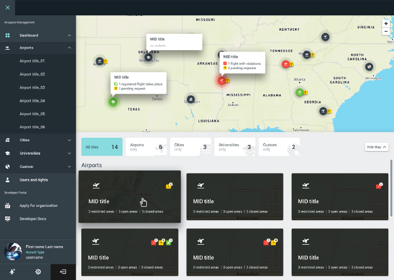
Production of quality, fresh, and precise aeronautical maps was the highest priority. Our data engineers enriched and normalized 2D maps for UAV navigation system with safety-critical third-party data: fly zones, temporary flight restrictions, powerlines, building heights, weather and more. As a result, we delivered a TileJSONspecification for use with Mapbox GL, which not only served the mapping needs of our platform but was also offered as a map SDK for drone data processing.
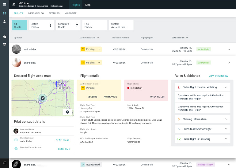
Planning and operating a safe and efficient flight required modeling a highly complex flight profile. The profile considered a number of conditions: aviation regulations, automated authorization in controlled airspace via D-NAS, mass distribution, energy consumption, weather and possible obstacles. Navigating such a complex terrain required precise and up-to-date mapping, regulation compliance, real-time airspace awareness and algorithmic knowledge.
What did our client get with the drone data management software?
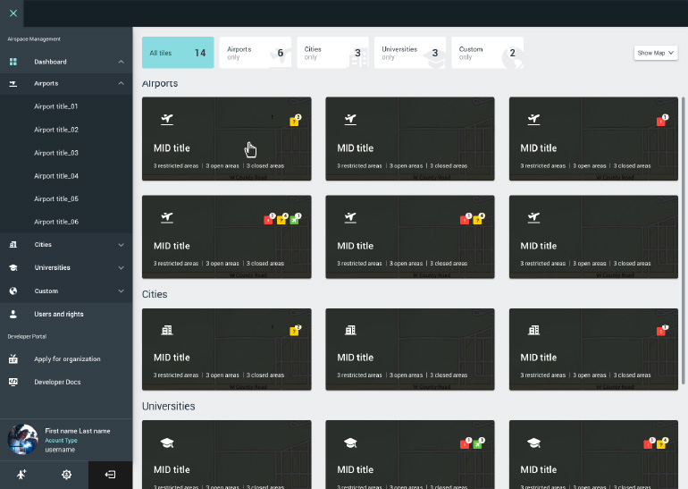
- Rich and auto-updated airspace vector maps
- Mobile and web apps for pre-flight planning and regulated flying
- Dashboard for communicating digital flight plans to airports based on D-NAS
- SDKs for developing custom web, iOS and Android solutions powered by airspace intelligence
- API for defining the level of safety to fly a drone to a specific coordinate
- API for geometry analysis of all local low-altitude airspace advisories
- API for identifying drones and authenticating drone operators
- API for running a search by drone metadata, manufacturers, and models
Business impact
The launch of the platform was a success: it opened the sky to 80% of autonomous drone software businesses in the USA. The platform granted instant, automated FAA authorization in controlled airspace that used to take up to 3 months. This engaged new clients from industries that could make use of drone fleet management: logistics, infrastructure, public safety, real estate, and construction, all of which serve populated areas and have high-security concerns. Together with the development teams of our client, Intellias engineers continue prototyping technologies for producing UAV maps, dynamic drone geofencing map, airspace design, congestion management, and terrain avoidance to set international standards for airspace integration requirements.
Benefits to the client:
- Airspace maps with global coverage
- Localization of aviation regulations for the USA, the UK, Japan, New Zealand, and Canada
- Display of no-fly zones by federal administrations
- Automating digital authorization with LAANC
- Built-in land elevation model as the basis for collision avoidance
- Obstacle identification based on real-time flight altitude, heading, and speed
- Visual and audible safety recommendations to drone operators
The way of working with Intellias offers us to increase our productivity while keeping our costs in check. The same time Intellias has a very interesting service model because it’s much more a partner. This is a premium partnership for us.